
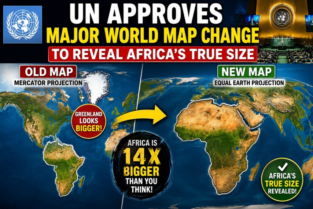
In a landmark diplomatic victory for the Global South, the United Nations General Assembly has voted overwhelmingly to adopt a resolution promoting a new world map that accurately reflects the true geographical size of continents. Spearheaded by Togo on behalf of the African Union, the “Correct the Map” initiative formally phases out the 467-year-old Mercator projection in favor of the modern Equal Earth cartographic projection. The resolution, passed on September 4, 2026, marks an international effort to dismantle centuries of “cartographic colonialism” that visually shrunk Africa, South Asia, and Latin America while expanding Northern Hemisphere nations
- UN Vote Outcome: Passed with 164 votes in favor, 1 against (United States), and 6 abstentions.
- Lead Sponsors: Togo and the 55-member African Union, supported by France and Germany.
- Adopted Projection: Equal Earth projection (developed in 2018).
- Phased-Out Map: Mercator projection (created in 1569 by Gerardus Mercator).
- Primary Geographical Discrepancy Corrected: On Mercator maps, Greenland appears roughly equal in size to Africa; in reality, Africa is 14 times larger than Greenland.
The Flaw in the Mercator Map: How Distortions Shaped Global Perception
Designed in 1569 by Flemish cartographer Gerardus Mercator, the traditional Mercator map was created specifically for nautical navigation. Because it translates a three-dimensional spherical Earth onto a flat, two-dimensional grid while preserving straight directional lines, it distorts the scale of landmasses relative to their distance from the equator.
As a result, high-latitude regions in the Northern Hemisphere—such as North America, Europe, and Russia—are vastly inflated. Equatorial regions, where most developing nations in Africa, South America, and South Asia are situated, appear severely compressed.
Real-Scale Comparisons Corrected by the Equal Earth Map
- Africa vs. Greenland: On Mercator maps, both appear roughly equal. In reality, Africa covers 30.3 million square kilometers compared to Greenland’s 2.16 million square kilometers.
- Landmass Capacity: Africa is large enough to fit the entire landmasses of the contiguous United States, China, India, Japan, Mexico, and Western Europe combined, with land to spare.
- South Asia & Latin America: The Equal Earth projection visually restores the true geographic proportions of South Asia, Southeast Asia, and Latin America.
How the UN Map Resolution Passed
The resolution gained momentum after the African Union formally endorsed the #CorrectTheMap campaign in August 2025. During the vote at UN Headquarters in New York, 164 countries voted in favor. France co-sponsored the measure, announcing that its national education system and government ministries would immediately transition away from the Mercator format.
The United States cast the sole dissenting vote, calling the resolution “superfluous,” while six nations abstained. Although UN General Assembly resolutions are non-binding, the endorsement establishes a international standard for educational curricula, media agencies, and digital mapping software.
The Equal Earth Projection: Science Behind the New Standard
Created in 2018 by cartographers Bojan Saric, Tom Patterson, and Bernhard Jenny, the Equal Earth map projection accurately presents the relative surface area of continents while maintaining visually pleasing landmass shapes.
By maintaining area proportionality, the map ensures that every square kilometer on Earth occupies the exact same proportion of space on the canvas. This eliminates visual bias, allowing educators, policymakers, and international bodies to view global demographics, climate vulnerability, and resource distribution without geographic distortion.
What This Change Means for Education, Technology, and Global Policy
The adoption of the Equal Earth projection triggers a shift across global institutions:
- Educational Curricula: Member states including Togo, France, and several African Union nations will begin updating school geography textbooks by late 2026.
- Tech Industry Engagement: The African Union and UNESCO are scheduled to meet with major technology firms and digital mapping providers in Lomé, Togo, early next year to integrate equal-area projections into digital mapping platforms.
- Diplomatic Weight: Geopolitical analysts note that presenting the Global South at its actual physical scale aligns with broader African demands for structural reform within international organizations.
The United Nations’ adoption of the Equal Earth projection represents a major step toward correcting centuries of visual bias in global geography. By accurately depicting the true scale of Africa, South Asia, and Latin America, the international community moves closer to a balanced visual representation of the planet. As governments, schools, and tech providers phase in the new map standards, global audiences will gain a realistic understanding of world geography